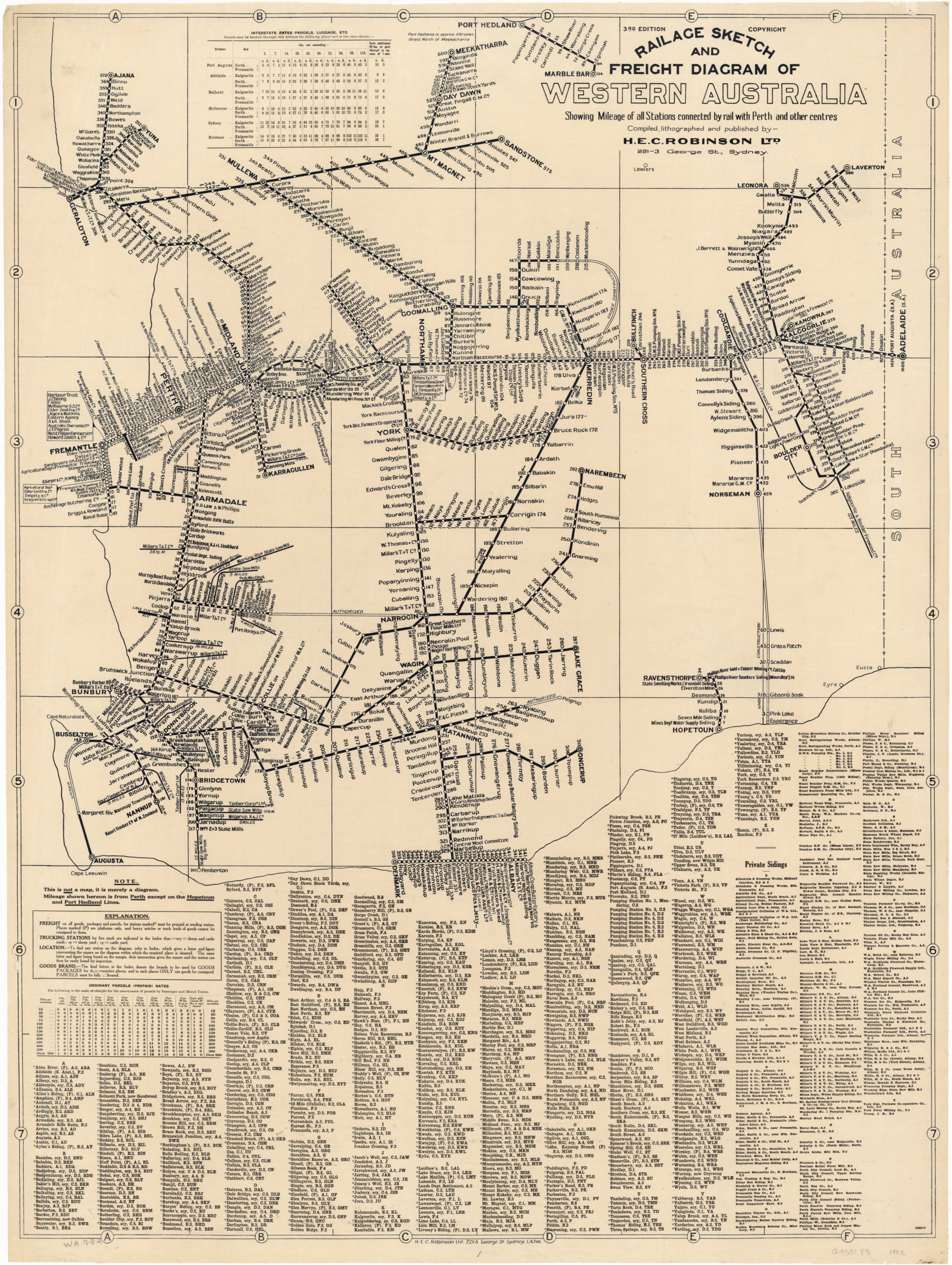
by rail with Perth and other centres, 3rd Edition, H.E.C. Robinson Ltd., 1922
I’d never seen this fantastic sketch of WA railways before when it popped up in a group on Facebook (“Railage Sketch and Freight Diagram of Western Australia”, 3rd Edition, 1922, H.E.C. Robinson Ltd.).
It’s not a map as such, more a schematic sketch of the railway routes, but importantly shows the name of every ‘station’ in the state at the time and mileage to Perth (or other centre). It’s a great resource for the club as we use WA station names on our main HO layout — deliberately picking one station starting with every letter of the alphabet to end up with 26 locations on the layout. (We had to stretch the rule about with ‘X’ — no stations in WA start with ‘X’! Instead we used the WA town name ‘Xantippe’ which was never served by the railways.)
This is another example from the wonderful free online resource that is Trove from the National Library of Australia: https://trove.nla.gov.au/version/26359059
That image above is quite low resolution — good enough to make out most of the names. The full, high-resolution version is a whopping 576 Mbyte image available from Trove (see link above) which is quite difficult to download or view even with a fast computer and good internet link. I have created a high resolution PDF version which is a much more manageable 13.2 Mbytes: nla.obj-233482959.pdf
Hiya, I am not a member of your group, but saw this image of the Railage Sketch 3rd Edition mentioned. I am just trying to date a version I have just acquired as it is 2nd Edition but mine has water damage to the bottom of the map.
Any assistance would be great, thanks
Hi Michael,
Your 2nd edition map is from 1921: https://trove.nla.gov.au/work/33128708
It is not available online, but there is a physical copy in the State Library of WA.
Cheers,
Ross.